Artifacts of the Anthropocene
The mixed media installation Artifacts of the Anthropocene explores the relation of geographic data and matter in endangered times and spaces. Focusing on the measurable changes in the ecosystem of the Lower Oder Valley, playing string figures with data sets allows to speculate about the end as the beginning.
„Playing games of string figures is about giving and receiving patterns, dropping threads and failing but sometimes finding something that works, something consequential and maybe even beautiful, that wasn’t there before, of relaying connections that matter, of telling stories in hand upon hand, digit upon digit, attachment site upon attachment site, to craft conditions for finite flourishing on terra, on earth.“
– Donna Haraway
Matter exists in a repeating cycle, through which it is always in connection with itself. It dissolves, assembles, decays and comes into being, lives and dies. What takes shape from it is also a result of the circumstances. Precisely what is created from matter depends on which components meet where and when. Ashes to ashes, dust to dust points to an order that sets passing away, extinction and disintegration as conditions of life. If dust, which unites the end and the beginning in itself, is to be found everywhere, then also in data which refer to space-time structures of the present?
The chosen data sets describe climate changes and indicators of the Anthropocene in the Lower Oder Valley. Light pollution, forest cover, closed depressions, wetness index, and the elevation profile were selected. This data is then correlated to three nesting sites of the critically endangered corncrake from 2021 and 2022 which have been recorded in the same area. Corncrakes nest in the tall grass of wet meadows and increasing drought threatens this species, like many others, with extinction.
Understanding Haraways string figures as a method, allows to connect geographic places in multiple dimensions. For this purpose, the data sets, which originate from the years 2012, 2017, 2021 and 2022, are arranged layer by layer in a virtual, three-dimensional model.
Starting from knots at the three corncrake nesting sites, connecting strings lead to points on the level below and form knots. From there, one or more strings lead to the next level and From there, more strings lead to the next level until all levels have been passed.
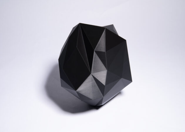
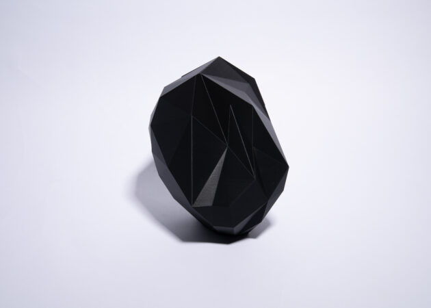
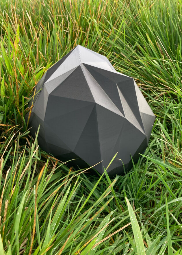
The strings and knots form a net body, a structure of spatial and temporal connections. The connections embrace a shape that describes the net from the inside. This network not only contains the given information, rather it allows for a context that is not about what qualities the nesting sites have, but how certain aspects of a landscape come together to interpret the site in a different way.
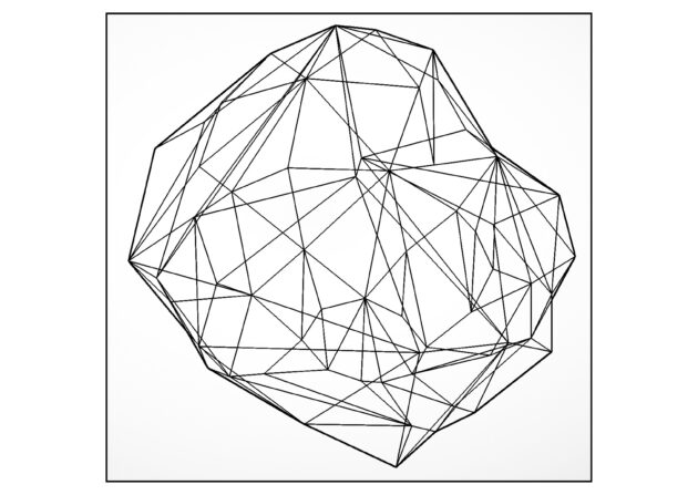
The interconnectedness of data knots expands their meaning. Together they refer to another point and form another shape. This play of string figures is a speculation and holds the beginning of a story. Its structure suggests that it might belong to something. Like a grain of sand was part of rock. Like dust trickling down from everything. Like ash, earth, like crystalline nutrients. The story of this string figure scales the big picture to a microscopic scale and adds a beginning to the end.
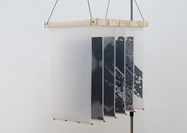
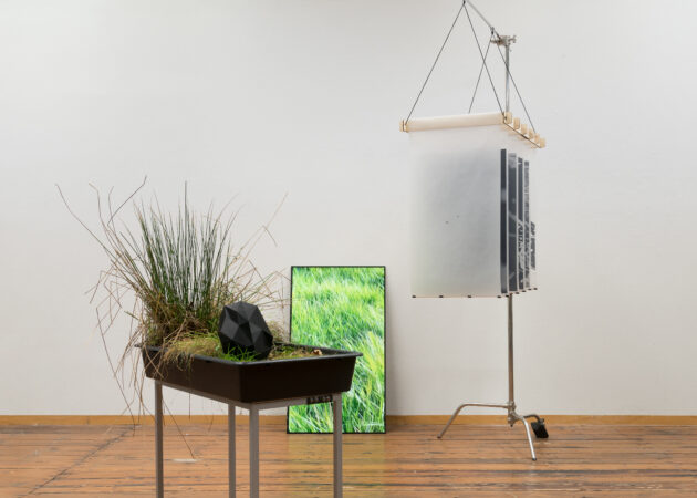
Horizontally arranged maps on hanging transparent paper show the data and refer to the multidimensionality of the place in space and time.
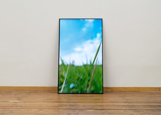
Video notes (5:52 min) provide glimpses into details of the landscape.